Manual Path Drawing vs. GEOlayers³ — The Difference in Time and Precision
The same final result can take hours manually or minutes with the right plugin
Short answer
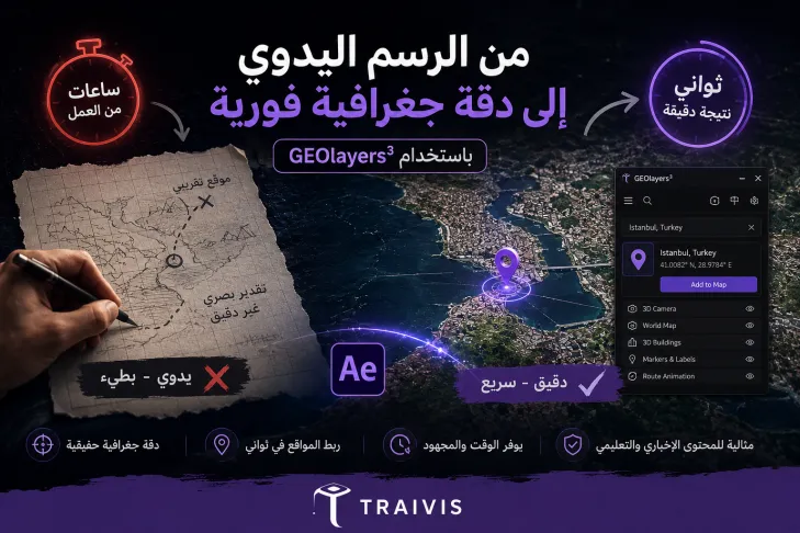
Manual drawing: full flexibility, long time
Manually drawing paths and locations gives full control over every detail, but takes a very long time, especially when real geographic accuracy is needed.
GEOlayers³: instant geographic accuracy
The plugin connects you directly to real maps, letting you search for any location and link it to the map in seconds, with guaranteed geographic accuracy, instead of trying to guess the location by eye.
Why geographic accuracy matters
In news or educational content, location accuracy isn't a cosmetic detail — it's the foundation of the video's credibility. A simple geographic error can damage your credibility as a creator.
The Map Editing with After Effects course on Traivis shows you how to use GEOlayers³ to search for locations and link them to the map through multiple methods, with real geographic accuracy that saves you significant time and effort.
Who is the instructor?
The course is taught by Abdelrahman Mohamed Sayed, a content creator and Motion Designer passionate about video and animation, specializing in editing and motion graphics using Adobe After Effects, Premiere Pro, and CapCut. His style is practical and simplified, explaining step by step so anyone can confidently enter video production.
To keep building your video skills, Abdelrahman Sayed also teaches Professional Editing with CapCut and Generating Videos and Images with AI on Traivis.
Takeaway
The right tool turns hours of manual work into minutes of precise results.
Links
Enroll on Traivis: https://traivis.com/ar/courses/montag-alkhrayt-bastkhdam-brnamg-adoby-aftr-afkt
Instructor profile: https://traivis.com/ar/profile/abdelrahman-sayed
Related course 1: https://traivis.com/ar/courses/almontag-alahtrafy-bastkhdam-brnamg-kab-kt
Related course 2: https://traivis.com/ar/courses/tolyd-alfydyohat-oalsor-balthkaaa-alastnaaay